At the east of St Leonard's is an area that was once referred to as Matford Field. It now consists of the land belonging to the houses in Matford Avenue, Leighdene Close, Matford Road, the flats on the east of Matford Lane and the houses in Wonford Road which abut on this. This is an attempt to describe the history and development of the area, with the aid of maps and pictures.
The history of St Leonard's by Diamond was published in 1873. The book included a map showing the church parish 100 years earlier. Madford Lane curves round to become Wonford Road and leads to Great Madford House (now Old Matford). Oddly, Bellair is not shown. The area of Matford Field is blank.
Diamond's second map shows several changes in 100 years.

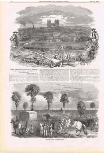
The two fields were covered with wooden sheds for animals and the latest developments in agricultural equipment. Afterwards there was an auction of fence materials and the wooden sheds --- recycling is not a modern idea, and possibly, the scrap materials from this show were handled in a better way than after some 21st century events where the priority is to get rid of things!
The next reference to the area comes with it being used for rugby, by Exeter's team, at the end of the 1880's. It appears that there were no facilities for changing and teams changed at a hotel in South Street!
In 1892, an auction was advertised, by which time the road layout had been planned. Here is the cover of the auction and the accompanying map.
However, at very short notice, the sale was cancelled. As can be seen from the map, there were now two houses on Matford Field, either side of Matford Road, at the junction with Wonford Road.
These had not appeared on another Victorian OS map, from about 1874, but the Great Field is now shown as an orchard, and the area to the east (Deepdene Close now) is Nursery and the grounds of Old Matford.
There are some odd aspects to the housing in this map. The former Lord Mamhead Homes has a strange garden shape using several plots from the 1892 sale map. Its neighbour to the south does not fit into any of those plots. A very strange curved boundary is shown for the original house at the north end of Matford Avenue, fronting Wonford Road. The large garden of Deepdene appears divided internally, with a strange deviation from the 1892 plots to accommodate a house in what is now Deepdene Park. The Matford Lane end of Matford Avenue is shown as parkland adjacent to Coaver. The southern arm of Matford Avenue has been developed.
And there is a tennis court in the angle of Matford Avenue. At some stage, the Vicars Choral of Exeter Cathedral (disbanded in the early 1930s) had owned much of old Matford Field as a recreational area, and their financial records show that local house-owners had to pay compensation for "loss of amenity" to this organisation. (That odd charge remains in the title deeds of several houses.) Watch out below for the tennis court!
During the blitz, some bombs fell in the area, and the records for May 1942 show a death in Matford Lane, but no mention of bombs in the area, although this is when --- supposedly --- Deepdene House was destroyed by a firebomb and other houses were damaged.
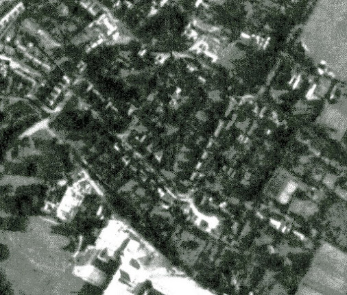
After the war, the RAF took aerial photographs of much of Britain. Here are some:
That's dated 30th September 1945 and shows the tennis court and a formal garden to the east of the ruins of Deepdene House, along with new houses in Deepdene Close.
10th June 1947 showing some areas which look like allotments at the west end of Matford Avenue
20th February 1957 --- the tennis court has gone, ready for new houses; Deepdene House gardens are being cleared.
26th July 1963; rather indistinct but the outline of Leighdene Close is clear; work is in progress on building County Hall.
And now:


.jpg)
.jpg)


No comments:
Post a Comment