Magdalen Road at night

Magdalen Road at night
December 2010

Sunday, 15 January 2012

Have you looked at the walls of St Leonard’s? (again)


Two years ago, I wrote the first of these articles about things to see in St Leonard’s, and that was about the garden and property walls around the neighbourhood.  This month, I would like you to look at the same walls, again, to see features that were not included first time around. 

As I wrote then, a great deal of the history of a wall can be gleaned by looking at the way it develops from ground to top.  Many local walls have foundations of one kind of material, with further layers added over time.  But this time, why not look along the length of the walls that face our streets, and you will find traces of the history of the street, and of the properties in the street. 

We can start with Magdalen Road, in the village.  Because we come to shop, most of us pay little attention to the walls of the houses that front onto the road, but there is variation along its length.  You will find, roughly, three sections.  The first, towards Fairpark, has sandstone walls; then a section of brick, and after Wonford Road, there are walls of a hard grey stone.  As each section runs in front of several properties, the sections are an indication of phases of development of the houses there.  Within each of these three parts, there are signs of change over time.  You can find a stone wall patched with brick, rearrangements to the walls as access to the house has changed, and repairs with newer materials.

Beyond the junction with St Leonards Road, the wall shows several stages of development.

Friars Walk and Lansdowne Terrace are among several local roads which show similar variety in front of the older houses along their lengths.  In front of the terrace of Colleton Crescent there is a fine example of a wall and railings which have not been significantly changed since the crescent was built.  The greensward opposite retains a fragment of a wall and ironwork in the same style, but sadly there are several parts of the railings missing.  Does anyone know whether the railing was spared being salvaged during the last war?

The walls around The Maynard School in Denmark Road, Barnfield Hill and Spicer Road give other opportunities for detective work about changes along their lengths.  In Denmark Road, there are distinct breaks in the style, one obviously for the garden on the corner of Denmark and Spicer Roads, and another further along, hardly noticeable under the trees.  Besides the modern break for the electricity substation in Barnfield Hill, there is a change from stone walls to brick part way up the hill.  And in Spicer Road, there are reminders of former gateways for the private houses which were there.

In Melbourne Place, the wall includes stones which once formed the lintel of a door.  This has been blocked; there are a few other walls with disused doorways around the neighbourhood.

While thinking about walls, there is an archway in the wall on the north side of Bull Meadow.   Presumably this is where the stream once ran, before being put into a culvert.  The first chapter of the popular history book, “The Time Traveller’s Guide to Medieval England” by Ian Mortimer opens in the valley of this stream.  “Four hundred yards from the city gate, the muddy road you are following crosses a brook.”.  The author’s imaginary traveller would then have climbed along the line of Holloway Street but would not have seen the distinctive mural, created at the end of the 1970’s and recently restored. 

That slope up to the city along Holloway Street possesses another wall that shows signs of change over the last few generations.  It is the wall of the Kingdom Hall of the Jehovah’s Witnesses, occupying the former premises of the Holloway Street Schools there.  Sections of the wall have been replaced over the years; does anyone have old photographs that predate the conversion to a place of worship?

(For those who may have missed any of the earlier articles, all are on the website lookatstls.blogspot.com.)
David Smith (Neighbourhood News, January-February 2012)

Monday, 5 December 2011

Magdalen Road Christmas Fair 2011

On Saturday December 3rd, Magdalen Road (also known as "St Leonard's Village") was closed to traffic for a Christmas Fair.  Here are some pictures from that event.

All photographs are copyright (under Creative Commons) David Smith

Pictures in which children's faces might be recognised have been pixelated for their safety.

Panorama 1

Panorama 2

The road was closed!

Mulled wine outside the Mount Radford

Musicians in the performance area

Refreshments from Cafe Magdalen


After dark, Gibson's Plaice cooked fish
Some of the stalls

Children's choir


Piper's Farm filling baps

There was a long queue for the cash machine

This was the day when there was a roundabout in "The Village"

More food!

Gibson's Plaice

After dark, the stalls were lit up

Aerobics from Zamora

The Christmas Fair after dark

Sunday, 20 November 2011

Magdalen Roads Shops Quiz

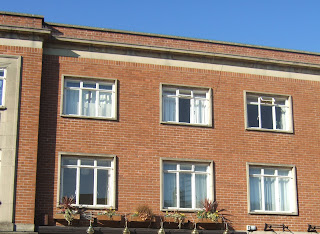
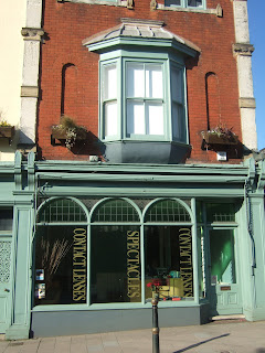
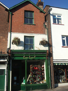
Can you identify these shops and businesses in Magdalen Road "Village" from the pictures of their upper storeys?
1

2

3

4

5

6

7

8

9


Answers:
1

 2

3

4

5

6

7
8
9


Monday, 7 November 2011

Have you ever looked for … St Leonard’s as it used to be?


We know that the city centre of Exeter was devastated by enemy bombing during the Exeter Blitz in 1942, and that other parts of the city were destroyed.  There are many books about the Second World War in the city and county, but most of the detailed description is about the loss of buildings in the centre of our city.  So what happened in St Leonard’s?

One of the most evocative pictures about the blitz that I have ever seen was a large scale plan of the Cathedral and the Close.  The plan showed a line of circles, in a line across the map, each one locating the spot where a bomb had fallen.  Equally spaced circles, corresponding to a succession of bombs dropped from one aircraft flying in a straight line across the city centre.  One could only speculate what would have happened if the plane had flown at a different speed, or had started to drop the bombs at a different instant.  As it was, two flying buttresses on the south of the Cathedral were destroyed along with much masonry on that side.  (If a third had been destroyed the Gothic roof of the cathedral would have collapsed, this being longest unbroken Gothic roof in the world.) It was a reminder that many of the enemy planes must have flown on straight lines across Exeter on that fateful night.  And, one suspects, their courses were probably parallel, just as in all those black-and-white war films.

One raid which affected St Leonard’s does get some prominence in the books, because the main effect was felt here.  That was the daytime bombing on December 30 1942, when several houses in Holloway Street and Attwyll Avenue were destroyed, and there were many casualties there.  Some houses in Holloway Buildings, a nearby Court, were also destroyed.  You can still see where the houses used to be, on the north side of Holloway Street close to the one-way system.

Many buildings were lost in the main night of bombing in May 1942.  A lot of the sites can be recognised because the buildings which disappeared have been replaced and the new structures are in different styles and materials from those around them.  Another aid to spotting “Lost St Leonard’s” is the front and side walls of properties, since these were often retained even if the dwelling was replaced. 

We can start with the most obvious set of new buildings, in the village, where the brick-built terrace of shops replaces a set which were destroyed, and these are matched by the flats opposite, replacing houses.  Amazingly, only one person appears to have died in Magdalen Road that night.  A few hundred yards away, another substantial loss was the whole of St Leonard’s Terrace.  You may wonder where St Leonard’s Terrace was, as it does not show on any modern map of the city.  The whole terrace was lost, along with several neighbouring houses in Premier Place, Park Place and Wonford Road.  And, today, in its place, you will find St Petrock’s Close, off Wonford Road opposite Park Place.  The terrace was a cul-de-sac, and the line of their frontages lies close to the roadway of the close; the houses had long gardens on the east side.  If you draw a line on the map between these two sites, it will pass over part of St Leonard’s Road, where, sure enough, there are several post-war houses which replace the older houses from that road which were lost.  And if you have a long ruler, and look further north, you will come to Newtown, severely damaged by bombs on the blitz night.  I suspect that a bomber on a close parallel path was responsible for other damage in St Leonard’s and the destruction of much of St Luke’s College.  Back in Magdalen Road, and further towards the city, there are the brick gate piers and some of the boundary walls of the North Park almshouses, replaced in 1953.

Two of the substantial end-of-the-19th century houses that were lost can be traced by their walls.  On the corner of Wonford Road and Matford Road there are gateposts marked “Lahill”, a lost house whose name has been taken by another house in Matford Road.  The coach house can still be seen.  Leighdene Close, off Matford Avenue, is a close of just over a dozen houses built in the extensive grounds of Deepdene, a house which was (reportedly) hit by an incendiary bomb.  Again, walls of the garden survive.  Less is visible of Feltrim Lodge, on Topsham Road, where Norwood Avenue now stands.  The Barnardo’s home “Feltrim” there was destroyed, with a bomb falling very close to where the children and staff were in their shelter, and the only casualty was one girl with a scratched knee.  (An unexploded bomb was found in Feltrim Avenue a few years ago.)

Where else did the enemy bombs fall around us?    The lists of damaged properties include houses in Rivermead Road, Bagshot, Egham and Feltrim Avenues, Spicer Road, Marlborough Road and Penleonard Close.  A house in Wonford Road near the Quadrant was lost as well.  Can you find the remaining signs of these properties?   There were also casualties in Matford Lane and West Grove Road.

(If anyone has photographs of “Lost St Leonard’s”, I should be very interested to see them.  By the way, I have referred to “The enemy” and not named a nationality.  After the Second World War, the city deliberately inscribed all its civic monuments in this way.)  In this article, there are a lot of loose ends which need to be sorted out.  If anyone can let me have details, I should be grateful.  I can be contacted through the website.

(Neighbourhood News, November-December 2011) 

The brick pillar and part of the walls of the former almshouses in Magdalen Road


Tuesday, 13 September 2011

Have you ever looked at porches in St Leonard’s?

Have you ever looked at porches in St Leonard’s?

A year or so ago, one of the local free magazines featured our neighbourhood as a good place to live, and included the description: “St Leonard’s is the Notting Hill of Exeter”, referring to the film that starred Hugh Grant in 1999. I commented on this amusing description to one of my friends, and she retorted, “Nonsense! Notting Hill is the St Leonard’s of north London!” Let’s put our national capital in its place.

Several of the scenes in the film centre around the front door and porch of William Thacker’s (Hugh Grant) flat. This issue, let’s have a look at the porches of our neighbourhood. And there is a huge variety. A porch is a structure whose purpose is to shelter and cover the front door. It is a small extension of our living space, a place where we move between the outdoor world and the security behind our front door. In that simple description, there has been scope for the imagination of architects and house owners.

Looking round St Leonard’s, it is quite difficult to categorise porches. Of course, not all houses have a porch. For a lot of houses the front door is in a shallow recess, offering a small amount of protection from the weather – provided the wind is in the right direction. Then there are some very simple porches, which offer a roof over the front step. Again, these are numerous in the streets of St Leonard’s. But look a little closer at the variety of roofs. It may be a flat projection, supported by brackets on each side. Or it may be pitched like a gable, draining to each side. Or it may be sloping, to left, right, or away from the house. The roof may match the house roof, indicating that it was planned to be an original part of the house. Thus many local houses have tiled porches, but others have clear glass panels above the front doorstep. In St Leonard’s Road, there are porches which resemble tents.

Look at the way such porches are supported; is there a beam across a wider space than the front door space? Or is the porch as wide as the door and little more than that? If the latter, is the roof on brackets, or is it supported on pillars? So what shape is the pillar, and what shape is the beam? Some porches are in a corner, needing one pillar, others have two.

Several older houses have flights of steps leading into the porch, or through the porch to the front door (pre-dating concerns of access for disabled people). Sometimes this creates a plinth for the porch, designed to impress the visitor. I have mentioned the mosaics at the entrance to The Lodge in Spicer Road in an earlier article. Other houses have rooms above a projecting porch, in the way that is often associated with Devon farmhouses. You’ll find examples of these in several roads, in houses of the twentieth century and earlier.

Instead of having the porch outside the house, there are many houses whose porch is integral with the building, in a recess. Many of these have been modified with panels to create an enclosed porch, just as many projecting porches have been enclosed. The result changes the architecture of the building, while providing a new room at minimal cost. It is interesting to wander down some local streets to see houses which were built at the same time, and whose porches may have been modified. Has it always been for the better?

Last of all, there are the porch rooms which were designed as part of the house, found in several Victorian houses in Denmark Road, and the older houses of Friars Walk and Magdalen Road. Once again, they offer a space for discarding outer garments, storing umbrellas and walking sticks, overwintering house plants and have a hundred and one other uses.

My favourite local porch has to be that of The Lodge in Spicer Road, but those at Woodhayes in St Leonard’s Road and The Maynard School in Spicer Road run it a close second. There’s a set of fine ones in Wonford Road below Woodhayes, and another in Victoria Park Road. Have a look for yourself and see which you find the most interesting!

Thinking about porches, there was a time when house names were written above the front door, on the lintel or on a pane of glass. Many houses in Denmark Road still have their names like this.

And while you are looking at porches, keep a look-out for the houses which still have coach houses. The wealthy Victorians who moved to St Leonard’s needed coach houses for their horses and carriages and some of these buildings remain, in Denmark Road, Lyndhurst Road, Victoria Park Road and elsewhere. Does anyone know which is the most recent house in the neighbourhood to have been built with a coach house? I wonder how many coach houses there are in Notting Hill?
(September-October 2011)
The Lodge in Spicer Road
The porch of The Lodge in Spicer Road


The porch of The Maynard School, seen from Spicer Road

Notting Hill porch
William Thacker's flat, the ‘blue door’ – now the black door: in  Westbourne Park Road, Notting Hill,

Have you ever … thought about and looked at what keeps you and your neighbours dry?

Have you ever …
Thought about and looked at what keeps you and your neighbours dry?

Slates have contributed a great deal to the architecture of Britain, Around every town and city the Victorian developments had their roofs in slate, either from Wales or, in the south west, from Cornwall. Look at an aerial photograph of Exeter and see the lines of grey roofs. Slate is light in weight (compared with stone), reliable in keeping the rain out, durable. And it is not monochrome; to call one colour “slate grey” is to ignore the range of colours in slate. Compare a slate roof with one that uses modern substitutes, and the latter is lifeless and dull because every modern piece is the same colour and texture.

Slates these days are expensive. So we have tiled roofs on many houses built in the twentieth century. This is nothing new, since the Romans made tiles for their civic buildings in the city two thousand years ago. The excavations for the Princesshay development produced over a tonne of fragments of Roman tiles. More recently, bricks and tiles were made from clay excavated in Newtown and Polsloe, where there was a very large brick and tile works.

There are very few tile-hung house walls in St Leonard’s. It is not part of the architectural tradition of the city. Towns in the South Hams are, justly, noted for their buildings with tiles and slates on their facades. But look carefully, and you will find several examples. There are some in Denmark Road, flats in Old Abbey Court and a house in Wonford Road. (Those in Old Abbey Court are a shade of green.) One in Denmark Road is a testimony to the skill of the tiler, with rectangular and curved tiles forming a pattern on the house-front. There is another fine example in Topsham Road, on the house that was (I assume) the gatehouse for the house called Abbeville, before the construction of Abbeville Close. Elsewhere, tiles have been used on gables and attic conversions, where there is a vertical non-structural wall. You can find tiles on a house extension in St Leonard’s Road, a bow window in the village, garages in Matford Avenue. East and West Grove Roads have bays with tile-hung cladding. Some of the gables in Rivermead Road have tiles, while their neighbours do not. And Egham Avenue and Bagshot Avenue, seemingly similar, differ – one has tiles on the gables and one doesn’t. There are also a few houses with cladding of real slate on part of their facades. I have noticed two in Salmon Pool Lane.

Keeping dry is not confined to what is overhead. In an earlier article, I mentioned the boot-scrapers that are a feature of many of the terraced houses in St Leonard’s. Many have been lovingly cared for, painted and repainted over the years, despite not being used much these days. Like so many features of houses, they are varied. Have a walk down one of the terraces, and count the number of different designs that have been used.

And while you are looking at what was provided before you reached the threshold of the houses, notice the thresholds and doorsteps of the houses. Once again, an earlier generation of builders decided that uniformity would be uninteresting. There are concrete thresholds, granite and slate ones, and numerous patterns of tiles. The last are a reminder of the influence of the late Victorian Arts and Crafts movement. The Lodge in Spicer Road has mosaic patterns on its doorstep. I wonder if they were laid out at the same time as those in St Matthew’s Church (below). Did Exeter have a mosaic business at the end of the nineteenth century?

While we are looking at the facades of houses, stop and look at the decorated brickwork of the buildings in St Leonard’s. It doesn’t take much to make a façade or brick wall interesting. You can incorporate a few coloured bricks (cream, white, or dark) into the ubiquitous red clays. You can add a few decorated bricks to create panels. Or you can design stringwork (or dentil work) running along a row of houses.

So, here’s a circular walk for a summer evening, looking at these features. Start at the Mount Radford Inn, walk along St Leonard’s Road, and into St Leonard’s Place. Take the passageway to Cedars Road and on into Radford Road, passing the old boundary walls. Drop down Radford Road and turn right into Roberts Road, Temple Road and climb up Dean Street to return via Fairpark Road and the village and some refreshment.
(July-August 2011)
 Mosaics in the choir of St Matthew's Church
Mosaic floor of the porch of The Lodge in Spicer Road

Have you ever looked at balconies in St Leonard’s?

Have you ever looked at … balconies in St Leonard’s?

Isn’t it interesting to discover new words? Not so long ago, I was looking at the property pages of the Express and Echo. One of the attractions of a local house there was that it had a “Juliet balcony”; maybe you live in such a house or flat? If so, do you stand there and dream of your personal Romeo, or is Exeter not so suited to romance as Verona in Shakespeare’s play? Once you know the expression, there are examples all over the place. Somehow I don’t think Juliet ever leaned over a “Juliet balcony” on the fifth floor of a block of flats, as I have seen elsewhere.

Coincidentally, a few days later, I came across the word “balconette” in a description of the houses in Colleton Crescent. (The reference is in Pevsner’s guide to the buildings of Devon.) Naturally, I was curious about the similarities and differences between balconies, balconettes and Juliet balconies. So I used a search engine for more information. Unfortunately, a search on the word “balconette” led to a long list of web sites related to women’s underwear! Amidst all these, there were links to some companies who supply Juliet balconies and balconettes for builders.

So, if you are looking for a Juliet balcony, such as can be found on the modern houses in Gras Lawn, it is a very shallow balcony, perhaps a foot (30 cm) deep, which provides a safe barrier when you open floor-to-ceiling windows on the upper floors of a house. It may not have any floor, and simply be a set of railings that are flush with the wall. Balconettes are a little deeper, but only big enough for a pot plant or two. In the Mediterranean, people have discovered that air-conditioning units fit comfortably on balconettes. Juliet would have difficulty standing on either, unless she took a very small shoe size.

Besides Colleton Crescent, there are some balconettes in St Leonard’s Road and Lansdowne Terrace. Juliet balconies are all over the area on modern flats and houses. In Colleton Crescent, the railings are curved to form an arc; the mass-produced modern ones have squared-off corners, though, doubtless, curved ones could be commissioned. At the end of the crescent, Colleton Chambers (or Colleton Villa) has curious balconies overlooking the river. A central bay window is flanked by two small balcony areas; should they be labelled “his” and “hers”?

Generally, balconies are large enough to sit on, and enjoy the fresh air. They are a way of creating a link between the outside world and the inside of your home, especially for people who live in flats or apartments without a garden. Older houses seldom have balconies – incorporating one in a house is a comparatively modern development, unless you are building a stately home. The Coaver Club on the County Hall campus has a very fine balcony overlooking the cricket field, and it provides a useful support when nets are used to protect the building when batsmen hit a six.

 Balcony of the Coaver Club
 
At the Heavitree Road end of Spicer Road, there is an unusual balcony on the second floor, on top of a two storey bay window. Several other bay windows appear to have balconies on top, but I suspect that they are generally flat roofs rather than useful balconies.

Balconies of all sorts are ways of linking the exterior with the interior of houses. As a result, many balconies are only visible from the rear of our houses; so what we can see from the roads of St Leonard’s will be part of the story. Similarly, there are numerous interesting verandahs on the ground floors of the district. I will leave those for you to discover!
(May-June 2011)