Magdalen Road at night

Magdalen Road at night
December 2010
Showing posts with label Bombing. Show all posts

Tuesday, 14 March 2023

A second walk along the walls (2023)

In the first of these walks, we went as far as Matford Lane along Wonford Road.  In the slightly warmer months of spring, we’ll go eastwards along Wonford Road to Barrack Road.  As I pointed out in the first article, until the 20th century, traffic flowed from Matford Lane into the east end of Wonford Road.  After Lyndhurst Road, the walls on the left illustrate three different approaches to using Heavitree Breccia (the sandy stone); the walls were the boundaries of three 19th century properties.  First a very well made wall of regular blocks from the local quarries --- regular meaning rectangular, even if not all the same size.  Past the gate, to the second property wall, and there are several very small “filler” blocks.  But the sad aspect of this wall is that the mortar has been repaired with a very hard concrete, which has led to damaged stones; water has been trapped behind the tough material, eroding the sandy material.  (On the opposite side of the road is the coach house of Lahill; the house was lost in the Second World War, and there are a few fragments of the stones of its boundary walls.)  The third part of the wall on the left of Wonford Road used lower quality stones and this material has been shaped by rainwater and the splashes from traffic in rainstorms.  The result is an irregular surface. 

Water splashes have created holes in the wall ---sometimes used for birds' nests

It is worth walking a short way along the two side roads here.  To the left, Victoria Park Road runs between two 19th century properties; on the left is Magdalen Court School, built around “Fairhill”.  Parts of its walls survive, most notably at the north end of the property, where there are stones from a rougher wall.  Turn round here, and look past the cricket pavilion to see the raised glass canopy of the structure In the grounds of Larkby --- a Victorian racquets court, a grade II listed building.  Once back at the junction, take a look down Matford Avenue.  On the left, there is an Edwardian brick wall, which provides a uniform front to the properties.  Opposite, the two blocks of 1930s semi-detached houses have a stone wall; it has been built with much smaller stones than those on the main road and show a range of types of stone, mainly Breccia and Pocombe stone, but with occasional pieces of trap and granite…probably what the builder had in his stock.  The smaller stones in these walls could be laid by one person; that’s not possible with the larger blocks in the older walls.

Larkby’s wall facing Wonford Road uses good quality Breccia, but even this may be eroded as can be seen at the corner by the postbox (installed in the reign of Edward 7th, reflecting the business from the increased number of local houses) and in patches further along.  Mardon House is built on the site of Matford Lodge, the lodge building for the eastern half of today’s Larkby Centre and its wall continues the Breccia --- but this section shows less attention to maintenance.  Further along, on the right is Old Matford with a 400-year old cob wall topped with tiles and protected against the weather with porous rendering.  The opposite side of road sees a sudden transition of material and quality.   

Irregular filling on the left

 Why?  Have a look at the kerbstones of the pavement; they are dropped, because this was a field entrance until after the Second World War, leading into the allotments which existed before the development of the Nuffield Hospital.  The walls look as if they have been formed from a heap of odd blocks --- put together with care, but not for aesthetics!  A little further, a second dropped kerb marks another former gateway, but the filling here is significantly better.   

Neat filling on the left

The stone wall comes to an end at the small stream just before the hospital entrance.  From the end of the Larkby wall to here, the original walls are well-built, but use a wider range of quarried stones than those used for the fine houses earlier.  Appearance was not so important for small-holders.

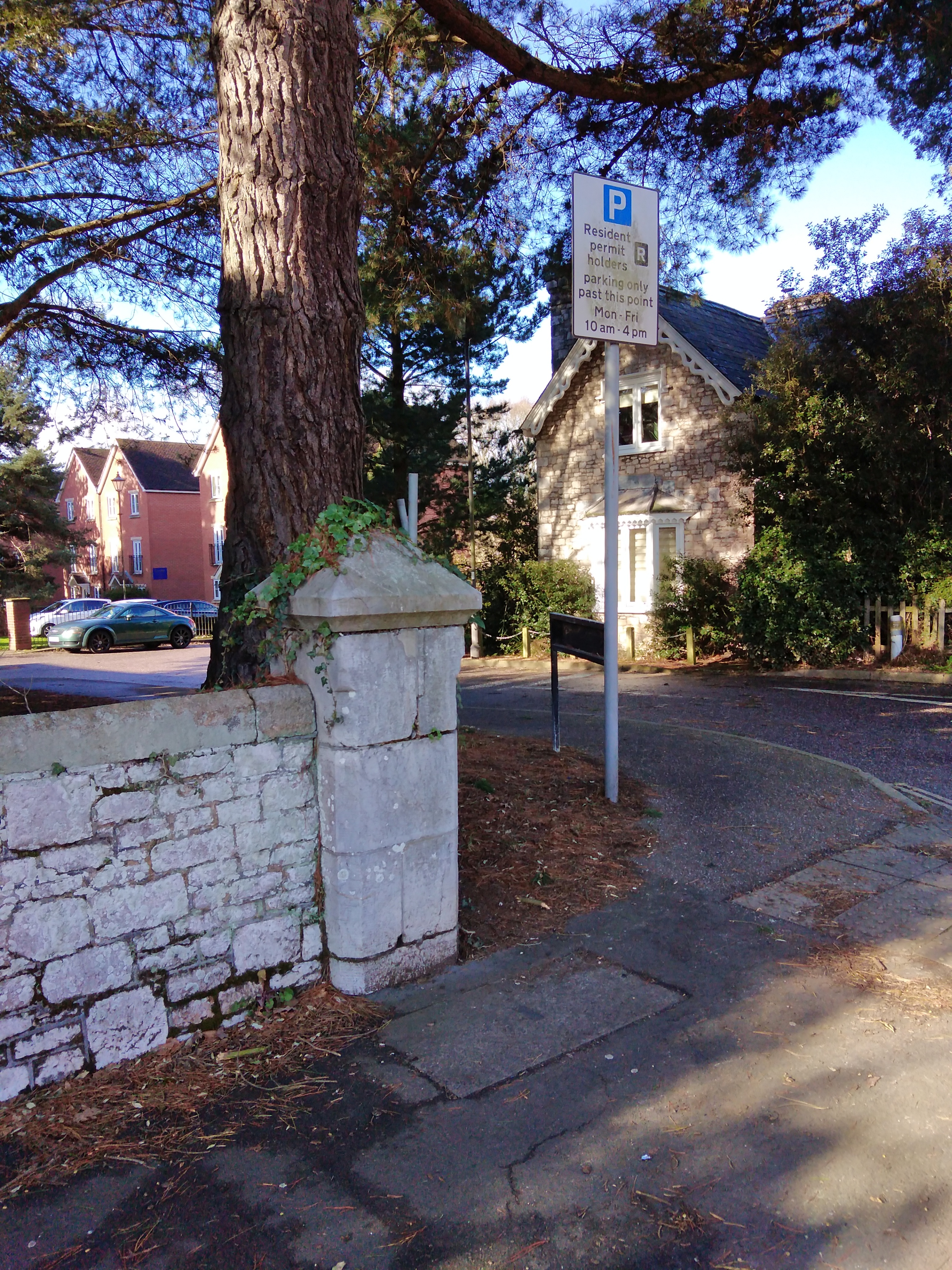
Entrance to Gras Lawn

Beyond the stream the old walls have been lost to development, but on the opposite side of the road are the limestone walls and lodge of Gras Lawn, the former home of members of the Veitch family.  It was a modest home, and the modesty extended to the small gateposts.  Barrack Road’s walls are a mixture from several eras and have been much altered over the 20th century.

Next issue we’ll explore some different walls.

David Smith  (http://lookatstls.blogspot.com/)

Keywords: St Leonards, Exeter, history, geography, beauty


Saturday, 11 July 2015

A book with a link to St Leonard's


The dedication of the book reads:
“To all Maynard girls, past and present, especially …”

Clare Morrall’s novel “After the Bombing” focuses on an Exeter girls’ school, a thinly disguised version of The Maynard.  And so it is a book with an obvious link to St Leonard’s neighbourhood.

The school is bombed in Exeter’s Baedeker raid, and four boarding girls are billeted at the university, as the boarding house is in ruins.  The hall warden, a bachelor, is perturbed by the arrival of young women in his men’s hall of residence, but we learn how the atmosphere changes, helped by music.  And we are confronted with the formidable head teacher of the girl’s school, determined that school life will go on, despite the damage to her building.

The novel takes us forward, and backwards in time, switching between the war, and the early 1960’s.  Twenty years after the bombing, one of those boarding girls is at the school, teaching.  The ghost of another of the quartet haunts her, as does the memory of the head teacher, who has just died.  Change comes to her, and the whole school, in the form of a new head teacher, with an ambition to advance the school’s reputation.  And a shock comes in the shape of the daughter of that same hall warden, now a widower.

This book will bring back memories of Exeter’s twentieth century life.  There are numerous references to the city, including a house in Magdalen Road.  Many readers will be caught up in the intricate relations between the leading characters, and many will recognise the human emotions that arise as a result.  Recommended.

“After the Bombing” by Clare Morrall is a paperback (or ebook) published by Sceptre.
(published in St Leonard's Neighbourhood News, July-August 2015)

Monday, 7 November 2011

Have you ever looked for … St Leonard’s as it used to be?


We know that the city centre of Exeter was devastated by enemy bombing during the Exeter Blitz in 1942, and that other parts of the city were destroyed.  There are many books about the Second World War in the city and county, but most of the detailed description is about the loss of buildings in the centre of our city.  So what happened in St Leonard’s?

One of the most evocative pictures about the blitz that I have ever seen was a large scale plan of the Cathedral and the Close.  The plan showed a line of circles, in a line across the map, each one locating the spot where a bomb had fallen.  Equally spaced circles, corresponding to a succession of bombs dropped from one aircraft flying in a straight line across the city centre.  One could only speculate what would have happened if the plane had flown at a different speed, or had started to drop the bombs at a different instant.  As it was, two flying buttresses on the south of the Cathedral were destroyed along with much masonry on that side.  (If a third had been destroyed the Gothic roof of the cathedral would have collapsed, this being longest unbroken Gothic roof in the world.) It was a reminder that many of the enemy planes must have flown on straight lines across Exeter on that fateful night.  And, one suspects, their courses were probably parallel, just as in all those black-and-white war films.

One raid which affected St Leonard’s does get some prominence in the books, because the main effect was felt here.  That was the daytime bombing on December 30 1942, when several houses in Holloway Street and Attwyll Avenue were destroyed, and there were many casualties there.  Some houses in Holloway Buildings, a nearby Court, were also destroyed.  You can still see where the houses used to be, on the north side of Holloway Street close to the one-way system.

Many buildings were lost in the main night of bombing in May 1942.  A lot of the sites can be recognised because the buildings which disappeared have been replaced and the new structures are in different styles and materials from those around them.  Another aid to spotting “Lost St Leonard’s” is the front and side walls of properties, since these were often retained even if the dwelling was replaced. 

We can start with the most obvious set of new buildings, in the village, where the brick-built terrace of shops replaces a set which were destroyed, and these are matched by the flats opposite, replacing houses.  Amazingly, only one person appears to have died in Magdalen Road that night.  A few hundred yards away, another substantial loss was the whole of St Leonard’s Terrace.  You may wonder where St Leonard’s Terrace was, as it does not show on any modern map of the city.  The whole terrace was lost, along with several neighbouring houses in Premier Place, Park Place and Wonford Road.  And, today, in its place, you will find St Petrock’s Close, off Wonford Road opposite Park Place.  The terrace was a cul-de-sac, and the line of their frontages lies close to the roadway of the close; the houses had long gardens on the east side.  If you draw a line on the map between these two sites, it will pass over part of St Leonard’s Road, where, sure enough, there are several post-war houses which replace the older houses from that road which were lost.  And if you have a long ruler, and look further north, you will come to Newtown, severely damaged by bombs on the blitz night.  I suspect that a bomber on a close parallel path was responsible for other damage in St Leonard’s and the destruction of much of St Luke’s College.  Back in Magdalen Road, and further towards the city, there are the brick gate piers and some of the boundary walls of the North Park almshouses, replaced in 1953.

Two of the substantial end-of-the-19th century houses that were lost can be traced by their walls.  On the corner of Wonford Road and Matford Road there are gateposts marked “Lahill”, a lost house whose name has been taken by another house in Matford Road.  The coach house can still be seen.  Leighdene Close, off Matford Avenue, is a close of just over a dozen houses built in the extensive grounds of Deepdene, a house which was (reportedly) hit by an incendiary bomb.  Again, walls of the garden survive.  Less is visible of Feltrim Lodge, on Topsham Road, where Norwood Avenue now stands.  The Barnardo’s home “Feltrim” there was destroyed, with a bomb falling very close to where the children and staff were in their shelter, and the only casualty was one girl with a scratched knee.  (An unexploded bomb was found in Feltrim Avenue a few years ago.)

Where else did the enemy bombs fall around us?    The lists of damaged properties include houses in Rivermead Road, Bagshot, Egham and Feltrim Avenues, Spicer Road, Marlborough Road and Penleonard Close.  A house in Wonford Road near the Quadrant was lost as well.  Can you find the remaining signs of these properties?   There were also casualties in Matford Lane and West Grove Road.

(If anyone has photographs of “Lost St Leonard’s”, I should be very interested to see them.  By the way, I have referred to “The enemy” and not named a nationality.  After the Second World War, the city deliberately inscribed all its civic monuments in this way.)  In this article, there are a lot of loose ends which need to be sorted out.  If anyone can let me have details, I should be grateful.  I can be contacted through the website.

(Neighbourhood News, November-December 2011) 

The brick pillar and part of the walls of the former almshouses in Magdalen Road